A deep dive into our budget vs. actual spending for our first two months of road life and a tour of Dinosaur National Monument – the fossils, the canyons, the river, the…poems?
This episode was written, recorded, edited, and produced by Lisa McNamara, with additional recording and editing by Paul Olson. Music by Michael Kobrin from Pixabay.
Subscribe:
Photos from this episode: visit our blog, Driving Inertia
Transcript:
This is Road Tripping in America, a podcast about life on the road. I’m Lisa and this is Paul.
We’re exploring the US in a pickup truck with a camper – we named our setup The Bobs.
If you daydream about long-term travel or overlanding or #vanlife – or maybe you’re already on your own adventure – join us for some entertainment from the road. We’re in search of off-the-beaten-path adventures and new experiences after a year and a half of standing still.
(music)
Today: we take a deep dive into our budget vs. our actual spending for our first two months of road life, and then we take you on a tour of Dinosaur National Monument – the fossils, the canyons, the river, the…poems? This is series two, episode five: Money and Dinosaurs.
This episode was recorded in the Kaibab National Forest at the edge of the North Rim of the Grand Canyon.
(music)
Lisa: Hi, Paul! Let’s talk money, finally. How much did we spend our first year on the road, back in 2011-2012?
Paul: We spent around $4,000 a month over the course of the year. That included things like car payments, always paying for camping – or almost always paying for camping at National Parks and National Forests, and that was pre-Obamacare, so there’s no subsidy for health care – that’s changed a lot.
Lisa: How did you decide what our budget should be this time around?
Paul: So we looked at what we spent last time as a starting point. We also looked at what we spent on a normal basis in our normal pre-nomad life, and then subtracted out what we were paying in rent and other kind of static living expenses. We looked at what other people have spent on the road, when they share their numbers. There’s a YouTuber called Far Out Ride, they live in a Sprinter van and mountain bike, they spend it seems like around $2,800 to $2,900 a month. So, we looked at other people’s data points to say, like, if we don’t spend a lot of money on camping, if we’re not paying for campgrounds, is that going to really impact the spending, if we can pay off our vehicle and take that into account, if we’re not paying rent, what’s that start to look like? And it looked to us like $3,000 would be really low in a month, but maybe possible, and $4,000 would probably be more of the high water mark, just like last time.
Lisa: How do you think about the budget – do you look at it on a daily basis or longer term?
Paul: So this time around, we’re looking at it on a much longer term. I think last time, we wanted to travel for a year, and we had kind of a finite amount of money – as happens when you save up money! And that was stressful, because, knowing that we wanted to get to this certain threshold of time, meant that whenever we were spending a little high, things were stressful.
I think this time around, we kind of look at it more like – well, that’s the money we’ve saved, we think it can go for a while, but it doesn’t matter, really, how long it lasts. And that has been a little bit less stressful.
Lisa: I definitely agree that getting away from looking at spend on a daily basis has helped a lot. We’re going to have more and less expensive days, and what really matters is the monthly bigger picture.
I think you kinda answered this already, but what is the official monthly budget?
Paul: We think it’s between $3,000 and $4,000 – target probably around $3,500 or a little lower. That works out to about $40,000 a year, if we get into that middle range.
Lisa: So how did we do the first two months?
Paul: Not bad! (laughs) So we knew we were going to start out hot, because we were going to Grand Junction to meet friends and stay for a little while in a hotel and go out to dinner a lot, and so July was $3,800. A lot of the things we anticipated being high were high – so we spent a lot on hotels, we spent a lot on food, but some things really helped us. We stayed 19 nights in free campsites, we spent 3 nights in free hotels using points, and that helped us stay under that $4,000 a month upper limit, so overall, pretty good month. So overall – July, we were in our range, we were a little on the higher end of that range, but I think our thought process going into it was that, we didn’t really know how it would shake out, and it ended up shaking out great, so we’re very happy with July.
In August, we spent $3,500. We spent around $100 less on hotels, we spent 15 nights in free campsites. The big different in August was that we had zero nights of free hotels – we didn’t use any of our hotel points. And when we got stuck in a rainstorm in the Wind River Range area, we splurged on some hotel nights so we didn’t have to hang out in the wet. So again, August was a great month.
It seems like our stretch goals are within reach – we can see how we can get to that $3,500 number regularly. And yeah – we did it month two!
Lisa: Any surprises or anything you didn’t expect?
Paul: In August, we drove a lot – we drove I think maybe more than we’ve ever driven in a month. We drove over 2,700 miles – over 1,000 miles more than in July, so that all added up to a lot of gas. We spent almost $100 more on gas and car stuff in August vs. July, and in July we had our first oil change.
The other thing that surprised us – that we could have anticipated! – was how much data we’re using with our cell phone plan. When we worked from home and traveled every so often, we would use 2 or 3 gigabytes of data in a month, because we’d mostly be on wifi. When we’re on the road, that first month we used about 14 gigabytes, and that’s with a lot of days being off the grid and having no connectivity, so we were really eating it up when we could get it. That’s probably going to continue. We’ll adjust based on that, because I don’t think it makes that much sense to ration data for $10 a gigabyte – it’s more than reasonable.
We knew going into it that we’ve have a lot of hotel points to spend, but, the rinky-dink hotels in these tiny little towns don’t affiliate themselves with the points that we have! So if we have a lot of Hilton or Marriott points, it doesn’t really help us at the Lander Holiday Lodge. They’re independent (laughs).
Lisa: Healthcare costs were another big surprise, right?
Paul: So Obamacare’s a big deal for us – not only do we have to not worry about preexisting conditions and where our coverage is going to kind of – run out, but the subsidy is a big deal. Because our income is now way lower than it used to be, we get a pretty generous subsidy, which makes our healthcare way more reasonably priced. I remember, after our last long trip, we were living in upstate New York for a few months, and when we tried to switch from our residency from where we had been living to upstate New York, the premiums just went through the roof and we realized we couldn’t live there!
Lisa: I remember getting a letter in the mail that our quarterly premium was going from a couple hundred bucks to over $4,300 and just being like – how is that even possible!?!
Paul: Yeah, it was thousands and thousands of dollars! That just closed that entire geographic region off to us.
Lisa: unless we got a real job there or didn’t have insurance.
Paul: So yeah, unless we didn’t have insurance, which is what we did. But you know, that’s not like, a real good long-term plan! (laughs) This Obamacare makes everything much more affordable. The coverage is just better. We have an HSA plan which helps for tax reasons. It’s just way more…what’s the right word? It’s just much more pleasant. Instead of having to like, fight this healthcare battle and know that you’re going to get screwed, to kind of thinking, well maybe – maybe this is OK. This seems like a reasonable expense, and we’re getting reasonable coverage for it in return.
Lisa: How do you see things shaking out, moving forward?
Paul: I think what we’ve seen so far should be heartening. That our expectations are kind of being proven correct – so we’re probably going to be around that $3,500 mark, plus or minus, depending on if we’re in towns with Hiltons and Marriotts vs. towns with independent hotels, if we’re able to find free camping two thirds of the nights, and if we’re able to maybe bring our driving down a little bit to a more reasonable level, to like, somewhere closer to 1,000 or 1,500 miles in a month instead of getting up close to 3,000.
All that stuff combined – you know, that’s what we want to do. We don’t want to spend all of our time driving, so it does seem like the trend we’re seeing is kind of the trend that we should expect to see for the foreseeable future.
Lisa: So budget-wise, we’re just going to keep being thrifty, hoping to make this last as long as possible. We’ll let you know how it’s going from time to time.
Hey, since you’re here – do you want to do high/low for August too?
Paul: Yeah yeah yeah!
Lisa: At the end of each month, we’ll share our high and low points from that month.
Paul: Alright, so I had two highs for the month. One was being able to meet up with friends. We saw our friend Rachel, we saw our friend Mark, we saw our friend Kathi. It was great to see those people and to kind of reconnect after not seeing them for a long time.
My second high was finally getting to some of the more difficult to reach Wind River Range trails. Hiking towards Jackass Pass, and getting close to the Cirque of the Towers, seeing all those granite peaks – that was really cool and something that we’ve been wanting to do for a little while. Next time we’re there, I’m looking forward to meeting my friend Eric, who also wants to go hiking in the area, and that’s going to be a lot of fun when we can make that work.
The low – I think I really had high hopes for western Colorado and finding a hidden gem of a town. And we were not successful in that. There’s a lot of cute towns, there’s a lot of neat areas, but none of them blew me away like I was kinda hoping they might. Colorado unfortunately seems to be fully discovered! The nice places are well known, the less nice places are kinda off the beaten path. Everybody knows Steamboat Springs is nice, everybody knows Durango is nice, I was hoping that that wasn’t the case.
Lisa: My low is our current, unresolved voter registration issue – we found out, two months after setting everything up, after getting both a confirmation email and letter from the CO secretary of state saying that everything was good, thinking that I had read and interpreted the rules correctly, we found out that our mailbox address would not actually work for voter registration. Unless we check a box that says that we’re currently experiencing homelessness. If we do that, then we can use the mailbox address. While we are technically currently and intentionally unhoused, I am really torn on officially reporting this. Until we decide what to do, our voter registration will be in incomplete status. And that kind of burns me up inside.
My high is the same as Paul’s – I’m so happy that we were able to see a few friends in August that we haven’t seen in a while. We also got to meet our new niece at the end of July, after we recorded our final July episode. Road life can be really lonely, especially now when we’re more hesitant than usual to go around talking to a bunch of strangers, so it always feels amazing to catch up with our people, and to have a new person added to the Olson team.
Alright – after the break, let’s go to Dinosaur National Monument.
(nature sounds)
(ad)
(nature sounds)
We lasted one day in southeastern Wyoming before deciding the weather was just too grim – cold, rainy, such that the mountain bike trails weren’t going to dry out for days and there was nothing to do while we waited other than freeze in the Bobs. So we zoomed way out on the map and checked regional weather and smoke plume patterns and decided to track back to our original plan to spend some time in Dinosaur National Monument, which we had bypassed earlier this trip because it was too hot then. It’s endless Goldilocks with us.
When we left the Pole Mountain area, east of Laramie, WY, it was 66 degrees and raining. And when we got to Irish Canyon, four and a half hours and 250 westerly miles later…it was 66 degrees and raining. Seriously. But I was in the desert. I love the mountains, but I’m a desert girl at heart, and I can even enjoy the rain in the desert because it’s so rare. I was just happy to be there.
By the way, Irish Canyon got its name from three Irishmen who allegedly stole liquor from a saloon nearby and then stopped in the canyon to get drunk. As a person of partial Irish descent, I resemble…I mean I can understand and appreciate their approach.
Different parts of Dinosaur National Monument appeal to completely different sets of people – so much so that there are signs at the start of a few of the monument roads that say something like “canyon only – no fossils here.” As if the canyon itself was somehow disappointing. But granted, it’s probably not what your six year old wants to see – they’re here for the dino bones.
The same geologic forces that caused triangular-shaped pieces of rock to stick up out of the earth like stegosaurus plates also exposed the layers where the dinosaurs were buried. According to the NPS, “23 rock layers are exposed at the monument, representing all of the documented geologic periods except for three. These 23 rock layers are remnants of extinct ecosystems spanning 1.2 billion years, from ancient seas, to plains where dinosaurs roamed, to Sahara-like deserts that were home to tiny, early mammals.”
Eleven different species of dinosaurs have been found at the original quarry site, where the exhibit hall and visitor center are located. This area represents one of the most ecologically complete assemblages of Late Jurassic dinosaurs in the entire world. Back in the day, when the quarry site was discovered and the first excavations were made, the bones were sent to museums all over the US and the world, just like the artifacts from Chaco Canyon and so many other places, with about as many controversial decisions made along the way.
Rather than reconstructing the skeletons, the Quarry Exhibit Hall instead features an exposed section of the rock layer where the majority of the bones are deposited. It’s a garbled, confusing mess that illustrates a few things very well – why so many species have been found here, why new dinosaur species continue to be discovered, even now, and just how special this place is. It’s fascinating to think that similar piles of bones lie in the rock layers underneath your feet in this area of the park. So I’d highly recommend a visit to the Quarry Exhibit Hall and the Fossil Discovery Trail, for anyone of any age who is fascinated by geology and dinosaurs. We just decided to skip it this time.
Because beyond the fossil section, there are the canyon sections that can be accessed by foot and then there are the Green and Yampa rivers. And the rivers are everything. According to the NPS, “Many of the 23 rock layers exposed within the monument are visible only in the river canyons.” Without the erosion action of the Green and Yampa rivers, these rock layers would still be buried deep beneath the Earth’s surface.
John Wesley Powell was famously the first white explorer to document his team’s two expeditions on the Green River and its canyons, and these expeditions were the source of many of the current place names, as the expedition teams filled in the blank spots on their maps. But Powell and his teams were not the first people to see these places. Trappers and traders had crossed the area. Generations of Native Americans had hunted and fished here. They just hadn’t put any names on the maps that were available to the people back east.
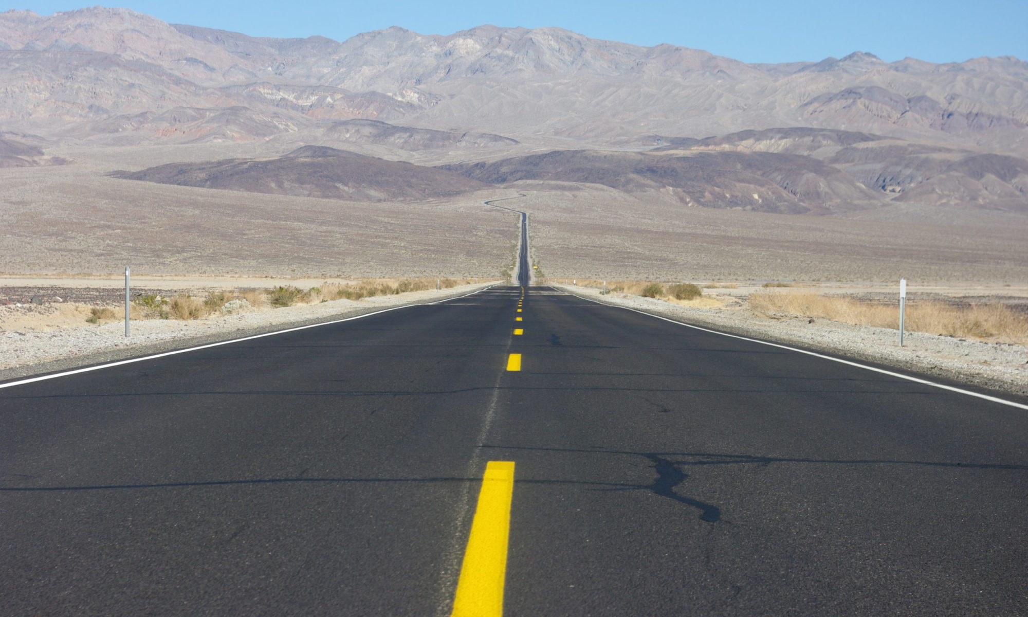
If you look at a map of the monument today, where in another national park or monument you’d see a road cutting through the center of the park, hitting all the highlights, at Dinosaur, the Green and Yampa rivers flow through the heart of the monument instead. To access many of the sections of the monument by road involves hours long drives, sometimes down sketchy dirt roads that are prone to washouts, and all roads end at the river – or nearby. Because it takes a lot more time than we usually have in a one or two week vacation, these spurs are easy to skip. But I was determined to see as much as possible this time – we were going to attack the monument from all sides.
Let’s start our tour!
Deerlodge Park, on the monument’s eastern end, is the launch point for permit-required river trips on the naturally flowing Yampa River. The Yampa is the only remaining free-flowing – undammed – tributary in the Colorado River system. Because the river is so low as to be unnavigable for the majority of the year, there isn’t much commercial activity happening on the river right now and this section of the monument is pretty much deserted. At the end of the road in this section, there’s a nice short hike to the mouth of a dramatic canyon, with all colors of rock layers, piles of rainbow-toned volcanic ash, caves in the cliff sides, an old rancher cabin. I want to put a kayak in the river here and poke around this section so badly. In fact, you’re going to hear a theme here…each spot we reached by foot or car only led to a cooler looking spot that could only be accessed by river, which means that I’m not done yet, I still have to come back again in the future.
A little bit west past Deerlodge on the main road, there’s a sketchy looking dirt road that leads to many dispersed camping sites on the BLM land up on the ridge overlooking the Yampa river valley. These sites seem to mainly be used during hunting season, based on the number of elk and deer bones scattered about. From the edge of the ridge, the sunset glow lights up the rock cliffs and valley beautifully and doesn’t help explain why some of the places in view have such depressing names like Vale of Tears and Disappointment Draw.
We were headed across this section of remote country to finally camp in Echo Park, a meadow at the confluence of the Green and Yampa rivers with amazing views of Steamboat Rock. But we didn’t get there this time. Ten years ago, we were (rightly) too scared to drive our minivan down a terrifying looking road that is signed “high clearance vehicles only” and “impassable when wet.” This time, our second attempt to camp in Echo Park, a place that some people call the most beautiful campground in the world, was foiled by a major downpour that caused a few washouts that had indefinitely closed one of the access roads and that made us nervous to trust the other, which is notoriously worse and more impassible in rain, and which the person at the visitor’s center had no info on. “I have no idea what the road conditions are – I have no way of reaching the rangers down there,” she said. As if I was super weird and off base to be asking the person the guide says to ask for road conditions before traveling, for road conditions.
So that was a big disappointment, especially after doing our homework in advance, seeing that all was supposedly clear, driving an hour and a half down a rough dirt road only to find a road closed sign at the edge of the monument, driving another hour and a half to the visitor’s center, and finding out that the road conditions website hadn’t yet been updated from the storm that had happened two days before. But Echo Park will be there next time. Thanks to David Brower and the Sierra Club, it will still be there for little kids to scream “echo” into and for us to make a third camping attempt at some point in the future, when rain is not in the forecast.
Historical aside here. If you’ve been paying attention to any of the popular news sources lately, you’ll have heard a lot of talk about the years long drought in the west that is causing water levels to fall in the big reservoirs in the region, some disastrously so. I’m not going to talk about that at all, because others – actual journalists – have done it much better. There was an article in The New Yorker that was particularly good – with a broad background on the subject for those just hearing about it and a few good factoids for those of us that already feel like amateur experts on the subject. But in these stories, we could have been talking about a Lake Powell behind the Echo Park Dam instead of the Glen Canyon Dam if things hadn’t gone differently, if David Brower and the Sierra Club hadn’t fought so hard for this place, both for what it was but also for what it was a symbol of, for the concept of protected land to actually mean something.
But when he died in 2000, David Brower’s son Ken said that the Echo Park/Glen Canyon “trade-off haunted him.” “Glen Canyon was what he considered his biggest mistake and the worst loss that happened on his watch.” “It ate at him considerably and it became an object lesson that he taught, which was ‘Don’t compromise.’” I get it for sure, because the Glen Canyon area and nearby Escalate National Monument is one of my top two favorite places that I’ve ever been. But I guess I’d throw David a little more of a bone. There could have been dams in both places without a compromise. At least one of these places was saved, and the fight did have lasting and positive impacts for land use and preservation.
Back to current day – after we failed to reach Echo Park, we were wary of attempting the long dirt road down to Island Park and Rainbow Park, on another road marked “impassable when wet.” For a region that averages less than 12 inches of rain a year, I think we were there for a good percentage of those inches. So we also bookmarked that for future, dry season exploration, and moved on up to Jones Hole Road. Thanks to a large national fish hatchery at the end of the road, the road is paved all the way to the end, where you can access a trail that takes you all the way down to the Green River.
The flow of the Green River through Dinosaur is now controlled by the Flaming Gorge Dam, making regular and consistent river trips possible, unlike on the undammed and seasonally flowing Yampa River. Which some people give as a pro on their pro/con list for dams.
This was by far my favorite part of the canyon section. There’s dispersed camping on the BLM land that adjoins the monument, and we got an amazing spot on the boundary, with views of a line of Zion-level cliffs. The Jones Hole trail, while long, passes through such incredible landscape, through a lush, deep valley that combines all the best rocks of Utah, like a greatest hits tour, alongside a river that now issues from the fish hatchery and feeds great crops of watercress in the stream and box elders and horsetail reeds and wildflowers along the banks. Along the way there are the best pictographs I’ve ever seen, perfectly protected from the elements by the undercut cliff they were painted on. At the end of the hike, where Jones Creek meets the Green River, by a bunch of campsites that were all deserted when we were there, we sat and ate a sandwich while the Green flowed by, still brown from all the runoff, and we didn’t see anyone float through.
Jones Hole was named for the Powell expedition’s photographer, Jones, and I hope it’s because it is such a beautiful place that Jones the photographer was just enraptured by it. Like, he was waiting to find a place that he really loved to put his name to, and this was it. In the expedition notes, Powell says it was named after Jones because they had a pleasant meal of trout from the creek, though. Powell wasn’t much of a poet.
But one of the members of his team was a poet at heart. The Gates of Lodore and Lodore Canyon, where we completed our circuit of Dinosaur National Monument, were named by the Powell Expedition after the English poem The Cataract of Lodore, because they said that, upon entering the canyon of Lodore, they didn’t have a moment of quiet until they left it in Echo Park, 18 miles later.
Standing at the Gates of Lodore, a deep red, steep, and dramatic canyon opening that you can reach by a mile-ish hike from the campground and boat launch, we watched a few expeditions of inflatable rafts, kayaks, supply rafts, and other floaties embark on their trips through Lodore Canyon and down the river from the very popular putting-in spot at this entrance to the park. I envied these lucky humans for the adventure that was to come. I want to float down the river so badly – I want to spend hours staring up at the canyon walls, seeing what only a relative handful of others get to see each year, eating tasty dinners from the supply boat, drinking one beer per river mile per person (which was the beer math we learned from our river guide on our short float in Grand Junction – that’s the amount that they plan to pack – our guide once piloted an entire supply boat full of only beer on a guided trip).
Later that night, a storm moved in and we heard the thunder echo between the cliffs of Lodore Canyon from our dispersed site on the BLM land above the park boundary. The hills around the red cliffs of the canyon are formed of a completely different material, a much darker rock with huge horizontal scores in it, like a giant beast had scratched it with its enormous claws. I can’t imagine how much more terrifying that thunder sounded to those camped in the river bottom sites. I can’t wait to hear the river – and the booming thunder – in Lodore Canyon too.
Until then, we have the poem, The Cataract of Lodore. Because this poem uses probably every single word in the English language that can be used to describe water – how it sounds, looks, moves, because this poem is so epic, verging on the ridiculous, and because it’s in the public domain thanks to being written in 1820, I’m going to read it all to you now. If you are a word or poetry hater, you can stop here and just be surprised about what we’re talking about next time. But consider giving it a listen – and let its sheer volume of water words wash over you like the Green River through Lodore Canyon.
(Ely Creek sounds)
Link to: The Cataract of Lodore, by Robert Southey
(Jones Creek sounds)
The end.
See what I mean? Every single possible word! Can you think of a word he missed? I’d love to hear it.
A few logistical notes for the Dinosaur National Monument area before we go: if you’re heading into the area, stock up well in advance. The park straddles the border of Utah and Colorado. The town of Vernal, UT is your best bet – it has everything you could possibly need and a couple breweries too. Rangely, CO is OK in a pinch. In Rangley, be sure to go to the Brunch Truck food truck, it’s the best, just delicious food. You can get a shower at the very chill Steinaker State Park north of Vernal, UT, which is also near a couple other nice hikes to arches and dino tracks and the mountain biking trails at Red Fleet Trails. It’s a great area, with so much to offer.
(music)
Next time: the listicle episode. We’ll talk about the eight things we think about on a daily basis and share three stories from the Wind River Range, told through the things we saved to ask Google when we were back in cell range.
Until then, check out our website, roadtrippinginamerica.com for more. If you are enjoying this podcast, please share it with a friend who’s also into travel, overlanding, or #vanlife. Thanks for listening!